START EXPLORING
The French (Napoleon) road
After the fall of the Roman Empire, there were not enough quality roads in Dalmatia, which hindered land transport in the region
LOCATION
Brela – Gornji Kričak
LENGTH
5.80km
DURATION
2h 15min
DIFFICULTY
Easy
This situation continued throughout the Middle Ages until the beginning of the Early Modern period and was solved only during Napoleon’s rule in Dalmatia (in the period between 1806 and 1813). This period saw high standards in road construction based on antique and Roman models
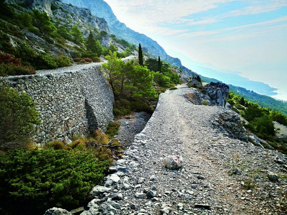
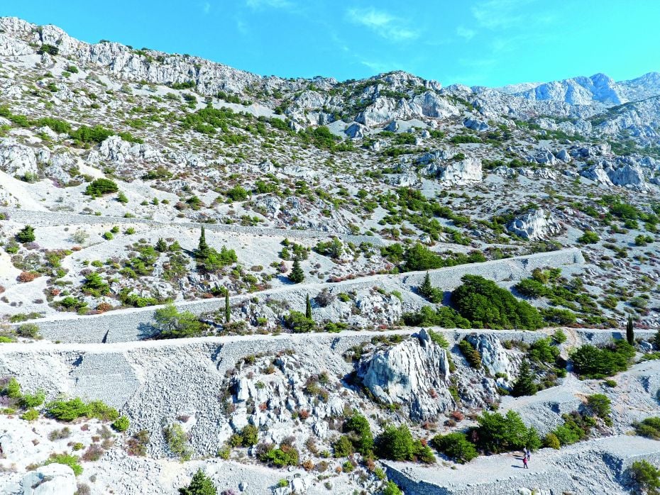
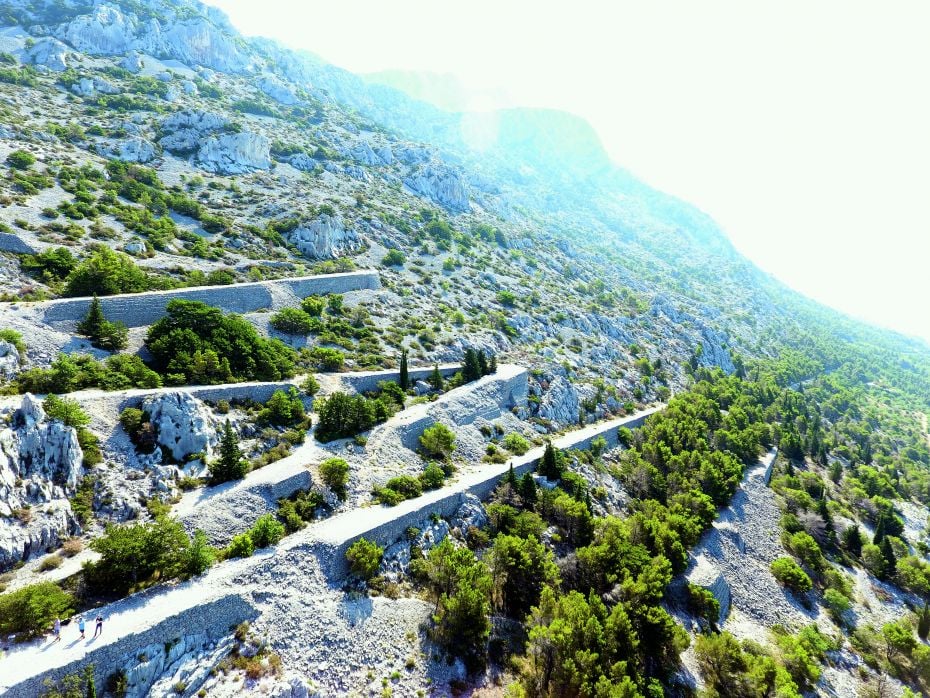
The French road on the slope of Mount Biokovo above the village of Brela in the Makarska Littoral is a part of this legacy. The route for the road was cleared in 1811 but was never finished. Because of this, we can today see all the phases of its adventurous construction in this extremely demanding and inaccessible terrain
 TRIAL INFO
Start your
adventure
TRAIL LINKS
DOWNLOADS
LOCATION
Brela – Gornji Kričak
DURATION
2h 15min
LENGTH
5.80 km
DIFFICULTY
Easy
ELEVATION
443 m
TYPE
Asphalt: 1.28 km
Macadam: 4.52 km
BOTTOM ELEVATION
138 m
TOP ELEVATION
443 m
START POINT
Brela – Gornji Kričak
END POINT
Brela – Gornji Kričak
START
43º 22’ 17.881” N / 16º 56’ 22.937” E Brela – Gornji Kričak, school parking area
0.65 KM
take the asphalt road to the crossroads in the direction of the Church of St. George (Sveti Juraj), then continue straight along the gravel road following the signposts (645 m)
2.00 KM
go along the gravel road to the vantage point, and from there continue left
2.50 KM
go along the gravel road to the start of the French (Napoleon) Road
3.60 KM
arrival at the first hairpin bend: either leave the French (Napoleon) Road on the left and go on to the chapel of St. Caius (Sveti Kajo), Bride’s Rock (Nevistina Stina) and Brela climbing route, or continue along the Napoleon Road to the top
4.00 KM
the highest point and end of the French Road, which abruptly ends in front of a tall rock, which must be by-passed from the south; continue along the path to Gornja Brela in the hinterland
4.40 KM
from the top of the road, we return along the same path for 400 m to the aforementioned exit towards St. Caius, Bride’s Rock and the climbing route (4,403 m)
4.70 KM
we reach the crossroads, which leads north to the Chapel of St. Caius and Bride’s Rock, and south to the Brela climbing route and Gornji Kričak (starting point, follow the signs for Brela – Gornji Kričak (4.668 m))
5.40 KM
arriving at the gravel road, follow the signs for the Brela – Gornji Kričak parking area
5.80 KM
return to the starting point